
California taps into the future of fare collection

January 24, 2022

California taps into the future of fare collection
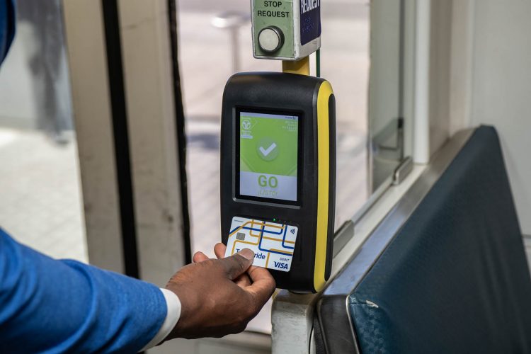

California taps into the future of fare collectionGillian Gillett, Program Manager of California Integrated Mobility at the California Department of Transportation, outlines the agency’s vision for a connected transportation network in California, which will offer riders contactless payments and better journey information.


The phrase “transportation in California” likely evokes images of vast tangles of freeway, the crimson contours of brake lights threading from desert to ocean. It’s true, the car is king in California. Cars account for more than eight out of 10 of the state’s commutes, while solo drivers make up three out of four. The result? Poor air quality, mind-numbing traffic and inadequate ways for carless Californians to get around.


Within this context, California has set ambitious objectives for sustainability, mobility and equity, and has positioned public transit as the cornerstone of its agenda to achieve these targets. But getting car-reliant Californians to park their cars and board a bus is no mean feat.


That’s why the California Department of Transportation (Caltrans) is trying a new approach to transit planning: think less like government and more like tech, and design transit that works for everyone.


To get there, in 2019, Caltrans hatched the California Integrated Travel Project (Cal-ITP), the state’s new incubator for mobility innovation. As a team of veterans from the technology and transportation industries, Cal-ITP is working with transit providers across the state to make riding transit an easy, intuitive and predictable experience that puts riders at the heart of transit planning.


To kick things off, we conducted a market sounding with a broad cross section of industry representatives for input on how California should improve the rider experience and increase transit’s mode share. Rather than the usual response from a handful of speciality vendors, the kickoff event saw front row seats occupied by heavy hitters from the payments and mobility industries, including PayPal, Visa, Mastercard, Google and Uber. Here’s what we learned:


California’s 300+ transit providers build and plan in silos. This lack of standardisation makes it impossible to invest in solutions that scale, resulting in bespoke systems that are not interoperable for either providers or riders

Innovation and standardisation in the banking and payments industries mean that legacy transit fare systems will not compete well.

The solution: unify transit across California with a single, interoperable payment system and real‑time data standard to make transit easier to use and more appealing to both new and regular riders. Specifically, Cal-ITP is crisscrossing the state to achieve the following three objectives:


Enable open-loop contactless payments: adopt the global contactless Europay, Mastercard, Visa (cEMV) standard as the state’s primary fare payment technology so that riders can quickly and easily tap to pay using their smartphone or the bank card that’s already in their wallet.

Automate customer discounts: streamline the process for riders to instantly qualify for and receive transit discounts (ie senior, veteran, student) when they tap to pay, regardless of which transit system in the state they use.

Standardise information for easy trip planning: remove the guesswork for riders wondering when the next bus or train will arrive by using the General Transit Feed Specification Realtime (GTFS-RT), the global standard for publishing real-time transit information, including fares and payment methods.

Creating a marketplace

When it comes to interoperability in transit, conceiving a system and building it are two entirely different matters. It’s essential that we make it as easy and affordable as possible for all transit providers – regardless of their budget or staff capacity – to procure the technologies that they’ll need. To that end, Cal-ITP has developed the California Mobility Marketplace1, an online catalogue of code-compliant products and services that transit providers will need in order to start using contactless fare collection and real-time GTFS data.


Cal-ITP is working with transit providers across the state to make riding transit an easy, intuitive and predictable experience”


The Mobility Marketplace takes an innovative approach to public procurement. Rather than having individual transit providers fend for themselves on the open marketplace to find the right technologies, it gathers and presents links to a suite of pre-negotiated, code-compliant products and services. This means that nearly all of the procurement work has already been done. For each product and service, Caltrans has already identified or advanced an RFP and leveraged the purchasing power of the State of California to negotiate deeply discounted rates with the selected vendors. All transit providers need to do is choose which products and services work best for them and sign on to existing contracts. This approach saves providers time and money and enables any agency, even those with little to no procurement experience, to design and purchase their own fare collection systems.


https://www.civilengineering.ai/california-taps-into-the-future-of-fare-collection/
Bird launches multimodal fleet in Rome

January 24, 2022

Bird launches multimodal fleet in Rome


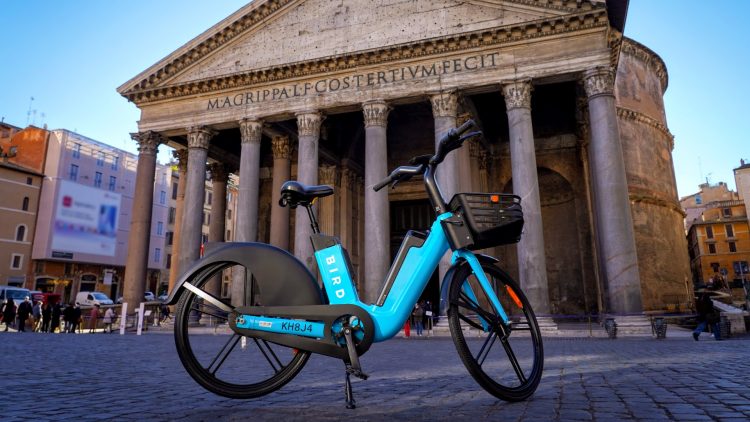
Bird launches multimodal fleet in RomeRiders in Rome now have access to hundreds of Bird e-scooters and e-bikes, as well as Zig Zag e-mopeds, following the launch of Bird’s multimodal fleet in the Italian capital.



Micro-mobility operator Bird has announced the launch of its multimodal fleet in Rome, as part of its Smart Bikeshare Program. In addition to Bird e-scooters, riders in Rome now have access to hundreds of Bird Bikes, as well as Zig Zag e-mopeds, directly on the Bird app.


First announced in June 2021, the Smart Bikeshare Program gives riders access to Bird’s brand new e-assist bikes, as well as local bike and e-moped operators, such as Zig Zag. The programme aims to help to increase sustainable mobility alternatives for Rome’s millions of residents and tourists.


Rome is the first city globally to offer riders a suite of three micro-electric vehicle options directly through the Bird app.


“Our partnership with Bird is helping to establish a new industry standard, one that benefits riders, cities and local businesses alike,” said Zig Zag founder, Emanuele Grazioli. “Integrating with Bird has given millions of scooter riders the opportunity to experience the benefits of e-mopeds. When operators like Bird and Zig Zag cooperate to make more clean transportation choices available, everyone wins.”


Each Bird Bike comes equipped with a host of safety and sustainability features, including dual hand brakes, advanced onboard diagnostics, aerospace-grade aluminium alloy framing and a maximum range of more than 50 miles on a single battery charge.


Furthermore, riders can easily access Zig Zag e-mopeds by simply tapping the clearly marked icons in the Bird app, which will then take them to the Zig Zag user interface to complete their rental.


https://www.civilengineering.ai/bird-launches-multimodal-fleet-in-rome/

Powerful sensors on planes detect crop nitrogen with high accuracy

January 23, 2022

Powerful sensors on planes detect crop nitrogen with high accuracy


Powerful sensors on planes detect crop nitrogen with high accuracySynthetic nitrogen fertilizers transformed agriculture as we know it during the Green Revolution, catapulting crop yields and food security to new heights. Yet, despite improvements in crop nitrogen use efficiency, fears of underperformance spur fertilizer overapplication to this day. Excess nitrogen then ends up in waterways, including groundwater, and in the atmosphere in the form of potent greenhouse gasses.


Predicting the amount of nitrogen needed by a particular crop in a particular year is tricky. The first step is understanding crop nitrogen status in real time, but it's neither realistic nor scalable to measure leaf nitrogen by hand throughout the course of a season.


In a first-of-its-kind study, a University of Illinois research team put hyperspectral sensors on planes to quickly and accurately detect nitrogen status and photosynthetic capacity in corn.


"Field nitrogen measurements are very time- and labor-consuming, but the airplane hyperspectral sensing technique allows us to scan the fields very fast, at a few seconds per acre. It also provides much higher spectral and spatial resolution than similar studies using satellite imagery," says Sheng Wang, research assistant professor in the Agroecosystem Sustainability Center (ASC) and the Department of Natural Resources and Environmental Sciences (NRES) at U of I. Wang is lead author on the study.


"Our approach fills a gap between field measurements and satellites and provides a cost-effective and highly accurate approach to crop nitrogen management in sustainable precision agriculture," he adds.


The plane, fitted with a top-of-the-line sensor capable of detecting wavelengths in the visible and near infrared spectrum (400-2400 nanometers), flew over an experimental field in Illinois three times during the 2019 growing season. The researchers also took in-field leaf and canopy measurements as ground-truth data for comparison with sensor data.


The flights detected leaf and canopy nitrogen characteristics, including several related to photosynthetic capacity and grain yield, with up to 85% accuracy.


"That's close to ground-truth quality," says Kaiyu Guan, co-author on the study, founding director of the ASC, and associate professor in NRES. "We can even rely on the airborne hyperspectral sensors to replace ground-truth collection without sacrificing much accuracy. Meanwhile, airborne sensors allow us to cover much larger areas at low cost."


https://www.civilengineering.ai/powerful-sensors-on-planes-detect-crop-nitrogen-with-high-accuracy/

HHI Group sets out to create new standard in sea transport with robotics and green fuel

January 23, 2022

HHI Group sets out to create new standard in sea transport with robotics and green fuel

HHI Group sets out to create new standard in sea transport with robotics and green fuelHyundai Heavy Industries (HHI) Group plans to set new standard in sea transportation through autonomous navigation, liquid hydrogen transport, and intelligent robotics technology


“Hyundai Heavy Industries Group has grown into the world`s biggest shipbuilder over the past 50 years. Now, it will become a “Future Builder,” creating new values for humankind,” said Chung Ki-sun, CEO of Hyundai Heavy Industries Holdings, while presenting the group`s future vision at CES 2022 at Las Vegas Convention Center (LVCC) on Wednesday.


HHI Group hosted a press conference for international press as well as Korean journalists at it joined the world’s biggest innovation event for the first time as a shipbuilder.


At the press conference, CEO Chung said, “I am proud of the past 50 years of HHI Group, which has laid the groundwork for the growth of the world. In the next 50 years, we will become the world`s best “Future Builder” and create new growth that is more sustainable, smarter, and more inclusive, something we have never seen before.”


The CEO presented autonomous navigation, liquid hydrogen transport and propulsion, and intelligent robotics and solution as the group`s innovative technologies that will lead the three core businesses of shipbuilding and offshore engineering, energy, and industrial machinery in the future.


“The driving force behind Future Builder is technological innovation. In particular, innovation in logistics and autonomous navigation technology that will reduce the risk of maritime accidents will become a new future for us. Eco-friendly ships and hydrogen value chains will be a solution to the energy crisis and climate change that threaten humanity,” he added.

Source: Pulse


https://www.civilengineering.ai/hhi-group-sets-out-to-create-new-standard-in-sea-transport-with-robotics-and-green-fuel/

Transdev to begin operating new Wellington bus service in summer 2022

January 23, 2022
Transdev to begin operating new Wellington bus service in summer 2022
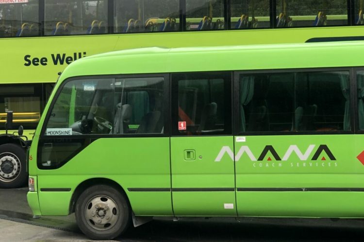
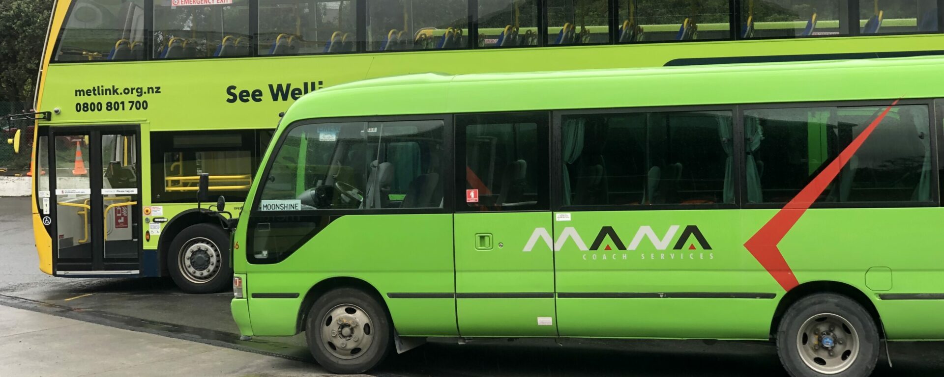
Transdev to begin operating new Wellington bus service in summer 2022Transdev subsidiary Mana Newlands has been awarded a six-year contract to operate a new bus service between Wellington Station and Wellington International Airport from July 2022.



Inhabitants in Wellington, New Zealand, will soon have an easy and convenient way to get to Wellington International Airport, with a new seven-day bus service funded by the Greater Wellington Regional Council and delivered by Transdev subsidiary Mana Newlands. The service is set to commence from July 2022 and will operate on the Metlink network and support Snapper ticketing.


“With a new service becoming part of the overall Metlink network, we’ll be able to see passenger journey data, exactly who is connecting to the service and from which parts of our region,” said Metlink’s General Manager, Scott Gallacher. “This will help us to make adjustments to our bus and rail network and target our resources better to meet demand from our communities,” he explained.


The new service will be operated by Transdev subsidiary Mana Newlands, with the company being awarded the six-year contract as part of a competitive tender.


Mana Newlands’ CEO, Craig Chin, said that the company was thrilled to have been chosen to operate the service, which will service 11 stops between Wellington Station and the airport.


New on-demand webinar: 'How Oxfordshire council improved design and public engagement using Remix Streets'


Featuring Sean Floyd, Partnerships Principal, Remix from Via and Joanna Mellon, Senior Project Manager, Major Transport Projects from Oxfordshire County Council


REGISTER NOW FOR FREE


“We’ve been a part of the local community for more than three decades, and the expansion of our services to Wellington Airport is a very exciting one. The last two years have been tough for many families and businesses, and we are very much looking forward to helping people to reconnect, particularly as international travel resumes,” said Craig Chin, CEO of Mana Newlands.


Currently, both Mana Newlands and Transdev are under contract with the Greater Wellington Regional Council. While Mana Newlands operates bus services in Newlands and Tawa, Transdev operates rail services in Wellington.


“Public transportation is all about people serving people, and there’s nothing that beats the warm welcome for those who are coming home or visiting our city, which is what our Mana team will provide,” said Greg Pollock, Transdev New Zealand’s Chief Officer. “We are excited to be delivering a cleaner, greener and comfier service for passengers with the route serviced by a dedicated fleet of 10 new zero-emission electric buses,” he said.
https://www.civilengineering.ai/transdev-to-begin-operating-new-wellington-bus-service-in-summer-2022/

Contactless cash: Ensuring that everyone is along for the ride

January 21, 2022

Contactless cash: Ensuring that everyone is along for the ride


Contactless cash: Ensuring that everyone is along for the rideKatherine Conrad, Director of Client Services at NEORide, discusses the introduction of cash payments for mobile tickets across the EZfare payment system and why this is key to ensuring that the needs of both transit and its passengers are met.



NEORide, a Council of governments comprised of 17 transit systems dedicated to the development and promotion of regional public transportation services, have launched cash payments for mobile tickets across the EZfare payment system (which is enabled by Masabi). EZfare is currently being utilised by 14 transit agencies across Ohio, Kentucky and Michigan. With the continuation of COVID-19 and transit agencies increasingly seeking contactless and low-touch ticketing solutions, this move ensures that cash-paying riders will still have access to touch-free services.


How does it work?

Transit riders can load cash by visiting any of the participating agency’s transit centres and use cash or card to buy mobile tickets or to add funds to their EZfare or Transit App Account. These funds can then be used to buy tickets when needed. EZfare’s other partner apps – Uber and Moovit – plan to make this feature available by the end of 2021.


When visiting the transit centre, riders simply need to present their in-app Account ID barcode and select the ticket that they would like to buy or their EZfare Account Barcode, then pay using cash or card. Agencies will use Masabi’s Justride External Orders API to securely send visual and barcode tickets directly to riders using the EZfare and Transit apps or add value to their EZfare Accounts.


In addition to transit centres, EZfare will be integrating with multiple nationwide retail locations in the autumn of 2021. Once this integration is complete, transit passengers will be able to visit stores associated with InComm’s VanillaDirect Pay programme and load cash on to their EZfare Account. This feature will only be available on mobile phones at launch, but will be expanded to EZfare smartcards in 2022. Retail stores associated with the programme include Dollar General, Family Dollar, 7-Eleven, Kum & Go, Speedway, Walgreens and CVS.


https://www.civilengineering.ai/contactless-cash-ensuring-that-everyone-is-along-for-the-ride/

Hayfield acquires site to deliver £21m green development

January 21, 2022

Hayfield acquires site to deliver £21m green development


Hayfield acquires site to deliver £21m green developmentHayfield has acquired a prime eight-acre site to deliver a £21m green development, featuring 50 eco-efficient luxury homes in Wiltshire, West Lavington
Hayfield has submitted a Reserved Matters Application to Wiltshire Council for a range of bungalows, maisonettes and two-, three-, four- and five-bedroom executive houses.


30% of the development will be designated for affordable housing and every home will have parking. The plans also feature air source heat pumps, energy-efficient underfloor heating, smart electric vehicle fast-charging points and ultra-fast broadband.


Hayfield intends to create a new access road and footpaths as well as 20 new drop-off car parking spaces for the use of parents and carers at Dauntsey Academy Primary School, located next to the new housing scheme.


With biodiversity in mind, an equipped play area, native tree planting, an attenuation pond, and a new area of pollen and nectar-rich wildflowers will be incorporated.


https://www.civilengineering.ai/hayfield-acquires-site-to-deliver-21m-green-development/

Mayor of London reveals cost of congestion as car use remains high

January 21, 2022

Mayor of London reveals cost of congestion as car use remains high


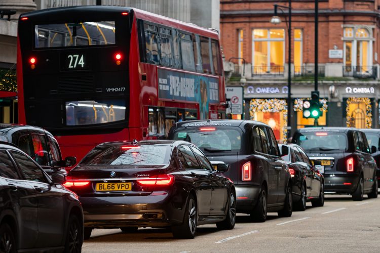
Mayor of London reveals cost of congestion as car use remains highDespite efforts to encourage the use of active travel and public transport, the Mayor of London has revealed that congestion in the capital is costing the economy £5.1 billion a year.


The cost of traffic congestion to the capital has been revealed by the Mayor of London, Sadiq Khan, as he warns the public of the need to increase efforts to deliver a green, sustainable recovery from the pandemic in order to prevent London from moving from one public health and economy crisis to another.


Although more than a third of car trips made by Londoners could be walked in under 25 minutes and two thirds could be cycled in under 20 minutes, statistics show that traffic on London’s roads costs the economy £5.1 billion a year, which equates to £1,211 per driver. While car use remained high, trips by public transport in 2020 dropped by 14 per cent compared to 2019, offsetting a substantial increase of nine per cent witnessed in the share of trips made by walking or cycling in 2020.


Encouraging active travel

Throughout the pandemic, the Mayor and Transport for London (TfL) have implemented measures which have aided significant progress in active travel, working closely with boroughs to transform roads and ensure that there is enough space for people to walk and cycle safely. These measures are playing a vital role in reducing congestion by enabling people to travel while taking up less road space, including walking, cycling and public transport.


More than 120km of cycle routes and tens of thousands of square metres of extra pavement space have been delivered. Cycling during the pandemic increased by 22 per cent in outer London compared to spring 2019, with a seven per cent rise in inner London. Participation has also broadened, particularly among people from ethnic minority communities.


Early signs of a car-led recovery

Furthermore, public transport ridership increased by 95 per cent and is currently still significantly behind pre-pandemic levels, with buses at 70 per cent of normal demand and Tubes at 55 per cent. Car use has been more resilient than public transport and has been the fastest mode of transport to recover to near-normal levels of use after each lockdown, with data showing that it has been close in reaching pre-pandemic levels for much of the latter half of 2021.


Additionally, data from external providers shows that, as the number of vehicle miles increased, so has the time lost by drivers due to traffic. TomTom data shows that, in 2017, an average of 144 hours per year, per driver, were spent sitting in traffic – amounting to almost 20 minutes extra for a 30-minute trip during the evening rush hour. In 2018, this increased to 147 hours and, in 2019, to 149 hours per year. This equates to six days and five hours in total for an average London driver. In 2020, despite traffic reducing, Londoners still spent an extra 15 minutes per 30-minute trip driving because of congestion.


As well as the financial implications, this has also caused significant health impacts, including increased risk of respiratory diseases, and children growing up with stunted lungs. Pollution leads to 4,000 Londoners dying early each year, all of which increases the economic and resource burden on the health service.


https://www.civilengineering.ai/mayor-of-london-reveals-cost-of-congestion-as-car-use-remains-high/

Tech Trends: Sensor Fusion Pushes AI Forward

January 21, 2022
Tech Trends: Sensor Fusion Pushes AI Forward
Tech Trends: Sensor Fusion Pushes AI ForwardCombining data from multiple sensors can ease the strict reliance on video surveillance when creating deep learning algorithms


At October’s annual CONSULT conference in San Antonio, I had the opportunity to moderate a panel discussing the current state of artificial intelligence in the security industry. The panel included Quang Trinh from Axis Communications, Aaron Saks from Hanwha Techwin, and Srinath Kalluri from Oyla, and we discussed the many challenges in moving AI forward – particularly the area of AI known as deep learning.


While I have defined deep learning in previous articles, lets summarize the concept for this column’s purposes as a form of AI where computers are taught to mimic the human thought process through multiple layers of algorithms known as “neural networks.” Within the security industry, the holy grail of deep learning would be the ability for computers to interpret video feeds to identify behaviors that constitute a security threat. Video analytics have that same mission, but they are focused on finding discrete elements based on very narrowly defined rules.


Deep learning algorithms would have the ability to interpret scenes based on a much broader set of rules – many of which the computer has defined itself through its own ability to learn from data.


Still a Ways to Go

While some sales and marketing folks would have potential customers believe that we are near the end-state of deep learning, in reality we are far from it. There are a multitude of issues with deep learning.


For one, in order for computers to be able to train themselves on what constitutes a security incident, they need massive amounts of annotated training data to determine what constitutes an actual threat. While teaching a computer to find a red balloon is easily achievable due to the massive number of free images available on the internet, video clips of security incidents are much more difficult to obtain. In addition, these clips would need to be annotated (i.e., this one is a video of a fight, this is a video of vandalism, this one is innocuous, etc.). Libraries of vast security-specific datasets are rare or nonexistent, and certainly not in a publicly accessible internet location available to solution developers. This problem is compounded by privacy laws, which in many cases would prohibit the creation of these libraries in the first place based on data retention limits.


Sensor Fusion Advances AI

One way the industry can make beneficial use of AI technology today is by combining data from multiple sensors. The concept of sensor fusion involves using multiple sensor types to create a more robust picture of reality that can help detect threats while also providing data used to train AI learning engines.


One company focused on sensor fusion is Oyla, which combines video data with LiDAR to create a 3-dimensional picture of a scene, as opposed to traditional 2-dimensional video feeds. I spoke with Srinath Kalluri, Founder and CEO of Oyla, about how sensor fusion will help advance AI technology.


“Neural network-based deep learning models, when combined with sensor fusion, ‘learn’ the environment and get better with use (data),” Kalluri says. “This enables the user to train the AI to recognize and eliminate false alarms. AI models can also be used to classify the nature of threats, further improving the accuracy of threat assessment.”


Sensor fusion also helps us move beyond a strict reliance on video surveillance as the only data source.
https://www.civilengineering.ai/tech-trends-sensor-fusion-pushes-ai-forward/

New tiny sensor makes the invisible visible

January 21, 2022

New tiny sensor makes the invisible visible


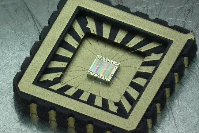
New tiny sensor makes the invisible visibleA TU/e research group has developed a new near-infrared sensor that is easy to make, comparable in size to sensors in smartphones, and ready for immediate use in industrial process monitoring and agriculture. This breakthrough has just been published in Nature Communications, with co-first author Kaylee Hakkel defending her Ph.D. thesis on January 14th.


The human eye is a marvelous sensor. Using three photoreceptor cells that convert visible light into signals for different colors, the eye gives essential information about the world around us.


"When our brain puts the signals together, it makes a prediction of what the signals mean based on our experiences. For example, a red strawberry is sweet, but a green one is not," explains Kaylee Hakkel, Ph.D. researcher in the Photonics and Semiconductor Nanophysics group at the department of Applied Physics and co-first author of the study.


Size does matter


While the human eye is impressive, it's far from being the most advanced natural light sensor out there. "The eyes of the Mantis shrimp have 16 different cells, which are sensitive to ultraviolet light, visible, and near-infrared (NIR) light," says Hakkel. "And measuring the spectrum in the infrared is most interesting for applications in industry and agriculture, but there's one major issue—current near-infrared spectrometers are just too big and expensive."


Hakkel and her collaborators have solved this issue by developing a near-infrared sensor that fits onto a small chip. And just like the eye of the Mantis shrimp, it's got 16 different sensors—but they are all sensitive in the near-infrared. "Miniaturization of the sensors while keeping costs low was a major challenge. So, we designed a new wafer-scale fabrication process to achieve this."


https://www.civilengineering.ai/new-tiny-sensor-makes-the-invisible-visible/

Lyft and partners launch autonomous ride-share service in Miami

January 21, 2022

Lyft and partners launch autonomous ride-share service in Miami


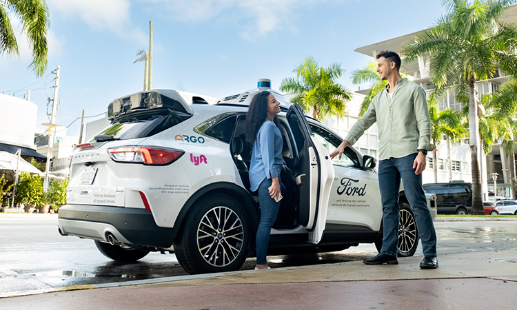
Lyft and partners launch autonomous ride-share service in MiamiAs part of an industry-first collaboration, Lyft and its partners have launched an autonomous ride-share service in the Floridian city of Miami, with the service set to expand to Austin later in 2022.


Lyft, Ford Motor Company and Argo AI have announced the launch of an autonomous ride-share service in Miami, U.S., delivering on a shared commitment to deploy Ford’s autonomous vehicles, powered by the Argo Self-Driving System, on Lyft’s ride-sharing network.


The launch of this service marks the first time that autonomous vehicles are available for ride-sharing in Miami as part of the collaboration between Lyft and its partners, which was announced in summer 2021.


An industry-first collaboration

In an industry-first collaboration, on 21 July 2021, Lyft, Argo AI and Ford announced that they would begin working together to commercialise autonomous ride hailing at scale. The unique collaboration brought together all of the parts necessary to create a viable autonomous ride-hailing service, including the self-driving technology, vehicle fleet and transportation network needed to support a scalable business and deliver an exceptional experience for riders.


“This collaboration marks the first time that all of the pieces of the autonomous vehicle puzzle have come together this way,“ said Lyft Co-Founder and CEO, Logan Green. “Each company brings the scale, knowledge and capability in their area of expertise that is necessary to make autonomous ride-hailing a business reality.”


Download our NEW 2022 Media planner


To assist in putting together your marketing strategy for 2022, please download our NEW 2022 Media planner which is packed with various opportunities for you to engage with Intelligent Transport’s ever-growing audience.


We are continuing our work with leading transport operators, authorities and associations alike on a range of multimedia content that pushes the messages that matter to our audience.


Make sure you are a 2022 Intelligent Transport collaborator.


DOWNLOAD HERE


Argo AI and Ford are responsible for deploying self-driving cars, with safety drivers, on the Lyft network as part of a network access agreement, with passenger rides now operational in Miami and due to launch in Austin later in 2022. As vehicles are deployed, Lyft users within the defined service areas will be able to select a self-driving vehicle to hail a ride.


This initial deployment phase will lay the groundwork for scaling operations, as the parties are now working to finalise agreements aiming to deploy at least 1,000 autonomous vehicles on the Lyft network, across multiple markets, over the next five years.


The collaboration is designed to scale autonomous vehicle deployment using market and safety data that helps to define where self-driving technology can safely serve consumers. As part of the agreement, Argo AI will use anonymised service and fleet data from Lyft to overcome the challenges faced by other autonomous vehicle companies by focusing on where they can build a sustainable business and validate deployment through localised safety data.


https://www.civilengineering.ai/lyft-and-partners-launch-autonomous-ride-share-service-in-miami/

Why IoT Sensors Need Standards They could improve performance and spur development of new applications

January 20, 2022
Why IoT Sensors Need Standards They could improve performance and spur development of new applications
Why IoT Sensors Need Standards They could improve performance and spur development of new applicationsSensors traditionally have been used for camera imaging, as well as communicating information about humidity, temperature, motion, speed, proximity, and other aspects of the environment. The devices have become key enablers for a host of new technologies essential to business and to everyday life, from turning on a light switch to managing one’s health.


Several factors are fueling sensors’ growth, including miniaturization, increased functionality, and higher levels of integration into electronic circuitry. There are also greater levels of automation being incorporated into products and systems, such as with Internet of Things and Industrial Internet of Things applications.


Prominent users of sensors include the defense, energy, health care, and transportation industries. The global sensor market is large and growing fast. By one estimate, it is projected to reach US $346 billion in sales by 2028, up from $167 billion in 2019.


SAFE AND RELIABLE APPLICATIONS


As the sensor industry races to take advantage of market opportunities, the need to ensure the devices will operate safely and reliably is a growing concern.


In the energy industry, for example, drill rigs for oil and gas exploration are now equipped with sensors to achieve optimal, safe performance at the lowest cost possible. The sensors must operate under harsh environmental conditions. Their failure could result in a rig being taken out of service, leading to significant, costly downtime.


In industrial applications, worker safety would be compromised if gas sensors fail to detect the presence of toxic fumes. If the light detection and ranging remote-sensing system lidar fails in semiautonomous vehicles, they will be unable to function properly. Lidar is fundamental to advanced driver-assistance systems (ADAS).
https://www.civilengineering.ai/why-iot-sensors-need-standards-they-could-improve-performance-and-spur-development-of-new-applications/

New method aids water prospecting and dam security

January 20, 2022
New method aids water prospecting and dam security
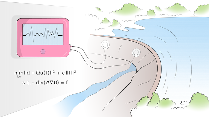
New method aids water prospecting and dam securityScientists from Skoltech and St. Petersburg State University have proposed a mathematical method for interpreting data on underground water flows. The new technique is more efficient and provides more accuracy in imaging fluids for planning construction works, inspecting dams for integrity, and locating water reservoirs for agriculture and private consumption in dry areas. The study came out in IEEE Transactions on Geoscience and Remote Sensing.


Detecting subsurface water flows is important for construction safety, dam monitoring, and groundwater prospecting. Underground fluid flows constitute a hazard for the foundation elements of buildings and subway systems, as well as an early warning of an impending dam breach. In dry climates, such as in Spain, Israel, Australia, or the south of Russia, knowing where water flows under the ground offers a way to tap into this resource for agricultural, industrial, and private needs.


The past decade has seen the rise of a new approach to underground water flow imaging: self-potential mapping. The underlying premise is that as water seeps through porous rock, it generates electrical potential, which indicates its presence.


The main challenge with self-potential mapping is that while researchers can reliably pick up these electrical signals, making sense of them and localizing actual underground flows has proved tricky. Until now, no satisfactory mathematical method has been available for processing large amounts of self-potential data for areas with rough terrain.


In a recent paper in IEEE TGRS, a Russian research team from Skoltech and St. Petersburg State proposed such a method. It is capable of rapidly processing many measurements and precisely accounting for the complex geometry of the studied domain. The latter is particularly important for identifying dam breaches, because dam geometry strongly affects the electrical potential.


“The ultimate result is that the method greatly improves the quality of geophysical interpretation,” the study’s first author, Mikhail Malovichko of Skoltech, commented. “Technically speaking, we are increasing the accuracy of the inverse problem. Considering the improvement in subsurface imaging, we believe this approach has great potential within the industry.”


*****


Skoltech is a private international university located in Russia. Established in 2011 in collaboration with the Massachusetts Institute of Technology (MIT), Skoltech is cultivating a new generation of leaders in the fields of science, technology, and business, conducting research in breakthrough fields, and promoting technological innovation with the goal of solving critical problems that face Russia and the world. Skoltech is focusing on six priority areas: artificial intelligence and communications, life sciences and health, cutting-edge engineering and advanced materials, energy efficiency and ESG, photonics and quantum technologies, advanced studies. Website: https://www.skoltech.ru/.
https://www.civilengineering.ai/new-method-aids-water-prospecting-and-dam-security/
 
Copyright © Ai4civilengineering