Metrolinx adjusts GO Transit schedules to combat COVID-19 impact

January 20, 2022

Metrolinx adjusts GO Transit schedules to combat COVID-19 impact


Metrolinx adjusts GO Transit schedules to combat COVID-19 impactMetrolinx will attempt to mitigate temporary labour shortages due to rising levels of staff absenteeism as a result of the new COVID-19 variant with reduced schedules and a ‘work from home’ mandate for its office staff.


Metrolinx, like many other businesses, has been experiencing rising levels of staff absenteeism due to the latest COVID-19 Omicron variant. As a result, in order to make the best use of resources and provide a consistent level of service, Metrolinx has announced that it is reducing rail service and adjusting GO Transit schedules.


Although absenteeism levels vary by department and by the day, frontline teams for the transit agency are now averaging 20 to 30 per cent fewer staff each day. This means that there are fewer employees available to operate trains, drive buses, maintain and clean vehicles or to ensure that adequate customer protection services are available when needed.


The absenteeism level at Metrolinx is expected to significantly increase, given the rapid transmission of the new variant, so proactive mitigation measures are necessary to protect critical transit services. In order to combat this, Metrolinx will be decreasing service across the network by approximately 15 per cent. Whenever possible, hourly frequency or better service will be maintained. As every part of the business is affected by high absenteeism, cancelled trains will not always be able to be replaced by buses.


https://www.civilengineering.ai/metrolinx-adjusts-go-transit-schedules-to-combat-covid-19-impact/

Keynote Preview: How can remote sensing and analytic technologies be applied to understand climate challenges?

January 20, 2022

Keynote Preview: How can remote sensing and analytic technologies be applied to understand climate challenges?


Keynote Preview: How can remote sensing and analytic technologies be applied to understand climate challenges?To solve or investigate planet-sized problems - like deforestation, climate change impacts, land use changes and more - you need a lot of data. The first hurdle is the collection of datasets bot


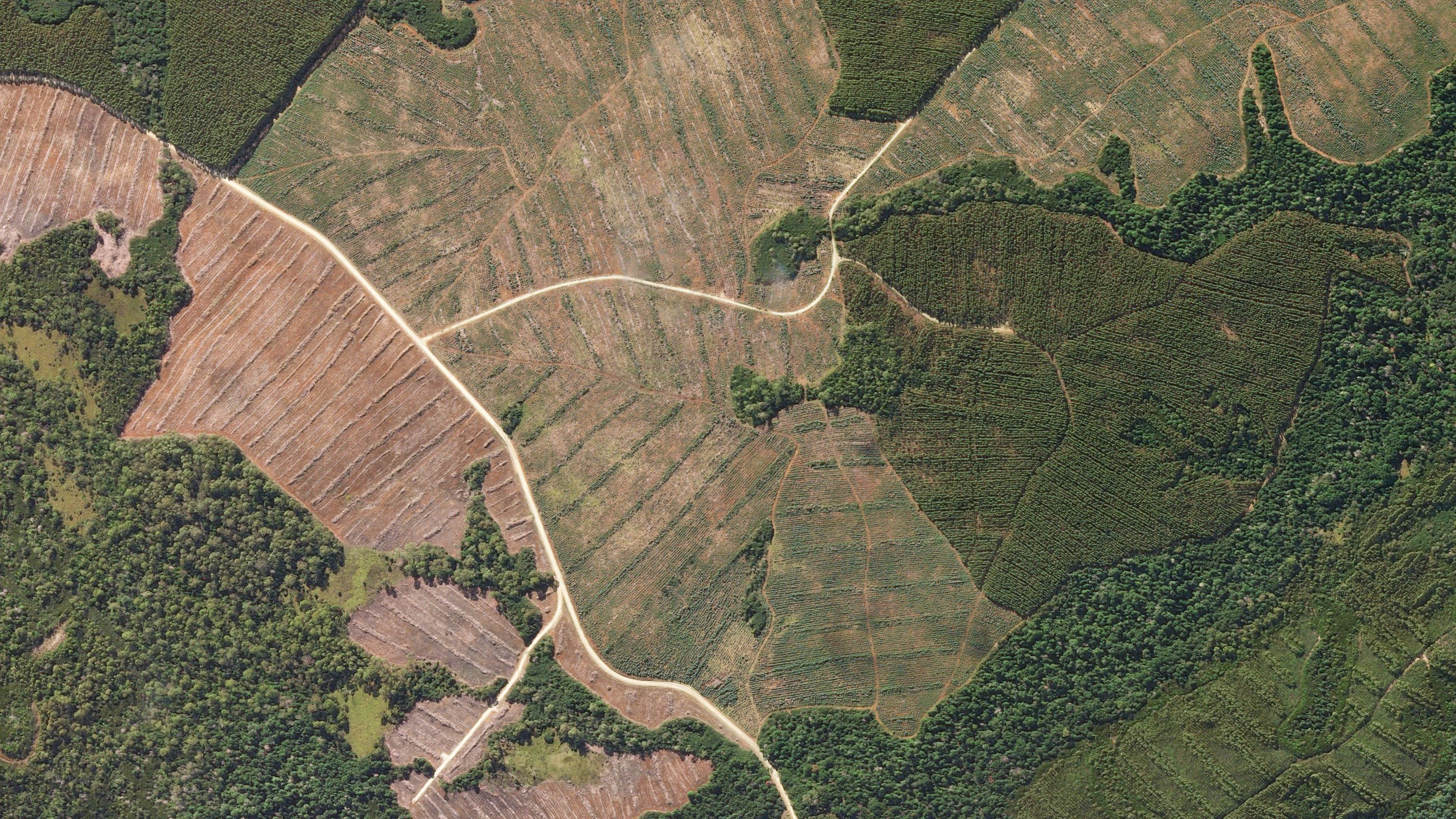
To solve or investigate planet-sized problems - like deforestation, climate change impacts, land use changes and more - you need a lot of data.


The first hurdle is the collection of datasets both at a resolution that is accurate enough to observe those phenomena and impacts and collected frequently enough to pinpoint changes over time. Remote sensing has benefitted from the explosion of satellites and data collection platforms now available, and the technological advances that have shortened the time from their development to launch. It is now possible to see our planet in more detail than ever before.


Hand in hand with these advances have been those in the processing and data management side, with machine learning and cloud computing enabling new ways of looking at huge, complex datasets that were not previously possible.


The intersection of these two advances - higher temporal and spatial resolution with better computer processing - is opening up a golden age of remote sensing, which means that companies like Planet can now develop tools to better understand Earth processes and our impacts on the environment. Even more importantly, these new insights can lead to actionable information.


Tara O’Shea, Director of Forest Programs at Planet, will join Geo Week to present a keynote that touches upon those advances, and what new challenges the data is helping us understand. In her upcoming keynote, O’Shea will talk about how global satellite data collected at high resolution and high frequency can be used to examine emerging environmental and climate challenges.


“There’s a mantra here at Planet: You can’t fix what you can’t see, and you can’t manage what you can’t measure. I think there’s nowhere that challenge is more true than in global forests.”


While researchers have been using satellite images and data to classify land areas for some time, the resolution was not specific enough and not repeated often enough to see short-term or even seasonal scale changes, says O’Shea.


“I think it comes as no surprise that land use is changing at much finer resolutions and much faster paces than that. Just having the capability to see everywhere, every day, at three meters resolution, and combine that with machine learning and cloud computing - the capabilities to detect and classify forests through the pace and scale at which change happens - is a huge breakthrough.”


Forests store carbon in their biomass, and when forests are cut down that carbon is again released into the atmosphere. It is estimated that around 20% of global greenhouse gas emissions originate from deforestation. Even that statistic, however, is an estimate that was based on lower resolution data - so honing in on the extent of forest conversion can provide much better insights into carbon inputs and outputs globally.


“While there are all these advances in remote sensing, optical lidar, SAR – there are also parallel advances in cloud computing and machine learning that are enabling these datasets to talk to each other in new ways.”


Combined with other sensors and with advanced analytical tools, questions about climate and human impacts are beginning to be explored.


https://www.civilengineering.ai/keynote-preview-how-can-remote-sensing-and-analytic-technologies-be-applied-to-understand-climate-challenges/

Smart Sensors Bring Breath Of Fresh Air To IAQ Management Solutions

January 20, 2022

Smart Sensors Bring Breath Of Fresh Air To IAQ Management Solutions


Smart Sensors Bring Breath Of Fresh Air To IAQ Management SolutionsIf there’s one thing we’ve learned following the pandemic, it’s that viruses are everywhere. From everyday surfaces to – and more commonly, might we add – floating in the air we breathe. Viruses and pathogens are transmitted from person to person at an alarming rate. In fact, COVID-19 is transmitted predominantly through the air, especially in indoor environments, according to the CDC. As such, it’s extremely important that businesses and communities prioritize improving indoor air quality (IAQ) moving into 2022.


Even before the pandemic, consumers paid attention to IAQ because of asthma and allergy diagnoses. With more businesses returning to the office, large arenas opening their doors to full capacity, and people feeling more comfortable to navigate indoor spaces, consumers’ awareness of IAQ is at its highest. And as expected, consumer awareness is driving interest in technology solutions that can effectively measure and analyze indoor air and environmental quality to keep individuals safe and healthy.


EMPLOYEE HEALTH AND SAFETY

There are a number of reasons why companies adopt indoor air and environment quality sensors. For starters, they equip facilities with the tools needed to support the health and safety of employees. Sensors placed indoors can monitor air quality, airflow, and test air levels for air pollutants from carbon monoxide to excessive dust and humidity. With real-time analytics, companies can gather data on air conditions around the clock to ensure employees are functioning in a safe environment.


LEADING THE CHARGE WITH LONG RANGE, LOW POWER TECHNOLOGIES

Growing interest in smart building technologies has led many to adopt IoT-enabled solutions. Built on wireless communication interfaces such as LoRa®, Wi-Fi, and NB-IoT, IoT-enabled sensors can be integrated into buildings easily. While more traditional options can be costly to install, long-range, low-power connectivity solutions offer a completely different approach by allowing seamless, easy-to-deploy integration into existing buildings.


Semtech’s recent collaboration with IQnexus is a good example of this. The collaboration uses sensors integrated with Semtech’s long-range, low-power LoRa devices to help facility managers monitor air quality in real time. These devices run via the LoRaWAN® standard which enables the sensors to wirelessly communicate with systems running standard building automation protocols including BACnet and Modbus via the on-premise or Cloud based IoT platform of IQnexus. The combination of the LoRa technology with LoRaWAN also provides IQnexus with an effective, always-on solution that can accurately track, monitor, and deliver data to buildings owners to keep individuals safe and healthy.


Implementation of indoor air and environmental quality sensors is made easy with IoT, as they are small and made to fit in hard-to-reach areas such as ceilings. Leveraging long- range, low-power solutions, these sensors can penetrate dense building materials up to three miles and have a life span of up to 20 years. This not only reduces costs associated with building maintenance but make for smooth, easy deployment.


SMART CITIES AND BUILDINGS

As we look to the future, we can expect air quality management to play a large role in smart city development. Maintaining the air quality of cities will also have a positive impact on IAQ as it takes into account the external environment for a specified area. The installation of long-range, low-power sensors within smart cities can help facilitate the exchange of information between indoor and outdoor environments from air quality management to other services such as lighting, parking, flooding, and more. This can reduce maintenance, costs, and deployment issues to benefit end users and the environment.


ENVIRONMENTAL BENEFITS

With the capability of identifying the source and type of pollutants present in the air, air quality monitoring sensors enable facilities to address the problem at the source. This is extremely beneficial to not only employee health and safety but for sustaining a healthy planet. Decreasing emissions reduces greenhouse gases that contribute to climate change. Data derived from air quality management sensors can be used to understand how pollution affects people, the environment, and mortality rates in specific geographic locations.


IoT-enabled smart sensors offer a low cost, easy-to-deploy solution to facilities looking to improve air quality management. In the future, we expect smart sensors will continue to be a more accessible and widely accepted standard of air quality and environmental monitoring as smart homes, cities, and buildings adopt this technology, and individuals place a greater focus on protecting the environment.


LONG-TERM EMPLOYEE BENEFITS

While the COVID-19 pandemic certainly raised the awareness on the importance of indoor air quality monitoring for health and safety, there was another unexpected benefit. Companies have now become more educated on the long-term benefits for their employee productivity through the correct regulation of temperature and carbon dioxide levels monitoring within their workplace. Wireless communication technologies, such as LoRa, can be easily implemented to ensure their employees are healthy and happier in the long term.


https://www.civilengineering.ai/smart-sensors-bring-breath-of-fresh-air-to-iaq-management-solutions/

Podcast | How digital engineering is improving project delivery

January 20, 2022

Podcast | How digital engineering is improving project delivery


Podcast | How digital engineering is improving project delivery | New Civil EngineerThe latest episode of The Engineers Collective is out now.


Jacobs senior associate director and practice group lead for intelligent asset management Steve Yule and Collins Engineers director of unmanned aircraft systems, artificial intelligence and reality modelling Barritt Lovelace join NCE editor Claire Smith and reporter Catherine Kennedy to discuss the use of digital engineering on their projects.


Network Rail and Jacobs have used digital twins on the Transpennine Route Upgrade, while Collins Engineers has adopted digital methods for the surveying work ahead of the Stone Arch Bridge Rehabilitation project in Minneapolis.


Both projects were winners in Bentley Systems’ Going Digital Awards in Infrastructure last month.


Steve and Barritt discuss how these new approaches can improve project delivery, reduce risk and create better outcomes. They also consider what the future looks like for digital technologies, and lessons learned so far.


Listeners can learn more about these and other projects in the Mobility gallery of Bentley’s Going Digital Awards in Infrastructure at: https://yii.bentley.com/en/award-finalists/mobility


To listen to the podcast click here.


The Engineers Collective


The Engineers Collective is proving truly global in reach, with a third of listeners based outside the UK. It is also appealing to an inquisitive, career-builder demographic, with 80% of listeners under 35.


Special guests on previous episodes have included Crossrail managing director Mark Wild, HS2 Ltd special advisor Andrew McNaughton and former ICE president Rachel Skinner. All are available for download and all address current and ongoing issues around skills and major project delivery.


The Engineers Collective is available via Apple Podcasts, Spotify, A-cast, Stitcher, PodBean and via newcivilengineer.com/podcast.


The Engineers Collective is powered by Bentley Systems. Around the world, engineers and architects, constructors and owner-operators are using Bentley’s software solutions to accelerate project delivery and improve asset performance for transportation infrastructure that sustains our economy and our environment. Together, we are advancing infrastructure.


Like what you've read? To receive New Civil Engineer's daily and weekly newsletters click here.


https://www.civilengineering.ai/podcast-how-digital-engineering-is-improving-project-delivery/

How local councils can make smarter use of road condition data to tackle UK’s pothole crisis

January 19, 2022

How local councils can make smarter use of road condition data to tackle UK’s pothole crisis


How local councils can make smarter use of road condition data to tackle UK’s pothole crisis | New Civil EngineerEnsuring optimum road conditions is an important priority for local councils. Survey figures from the Asphalt Industry Alliance discovered that councils were filling a pothole at an average of every 19 seconds in 2019-20.


This task can often be made challenging with adverse weather conditions regularly creating problems for motorists and highway users, with local authorities also needing to care for drains on the road, manhole covers, road markings and signs. As a result, UK councils are looking to collect and harness high-quality UK data from across their highways network and use it to make informed decisions about the future of their roads.


A challenge that councils face however is the time it takes to complete a conventional survey, with budget constraints and a need to focus on other critical public-facing services also creating hurdles. The conventional process typically involves data collection over the course of a year before the results are received, which then need to be interpreted before maintenance is carried out.


Working smarter with technology


Maintaining roads and highways to a suitable level is a hard-fought process, but with the right technology solutions, it doesn’t have to be. With high-quality video data and computer vision to assess highway conditions accurately, combined with asset management software solutions, data can be interpreted quickly and easily, while maintaining quality.


This combination of technology solutions provides a comprehensive level of visibility to councils, down to the height and texture of the roads. It can also include the state of infrastructure such as streetlights and highlights jobs that need to be done or are currently being addressed. Moreover, councils can access strategic decision support for maintenance and investment options relating to carriageways and pavements.


For councils, it facilitates a way to work smarter and faster without compromising on accuracy. With the responsibility that local authorities have to serve their communities, innovation can often be perceived as a risk, but the bringing together of these technologies allows them to gain the benefits of innovation while minimising risk.


Rather than a project taking place over years, UK councils and highway authorities are able to utilise the technology to replace existing road condition survey methodologies. Quick data collection means that a plan can be developed in the space of just weeks and the maintenance programme can then take place in the same season.


Wide-ranging benefits


Use of these solutions allows councils to benefit from early intervention asset management. This means engineers can collect geospatial video data at every occurrence of going out to the network, whether it’s an ad hoc call out or as part of a routine network or safety inspection. Additionally, local authorities are able to automatically process video data to produce condition surveys, avoiding a situation where an external agency needs to be booked for a survey to be commissioned, depending on its resource available, between six and 12 months in advance.


Survey vehicles are also expensive, costing anywhere up to half a million pounds. A key focus is on the integration of IoT in new assets as they are implemented, giving councils the visibility they need, but it’s also crucial to integrate sensors into older assets to ensure that they can access data of aging infrastructure and act to rectify it. Technology also facilitates the ability for the council to undertake condition surveys on a risk-based approach following inspection, creating the ability for more regular condition assessments to be carried out.


Fast defect discovery


With the early intervention asset management capabilities made possible by supporting technology, councils can crucially identify a network defect as soon as it starts to occur. What this enables is the ability to make an early intervention and target treatment plans at minor defects that have just materialised. Acting earlier before a defect deteriorates further enables councils to implement lower cost treatments, helping them to keep tighter control on budgets and allocate finances to other crucial public services. At the core of this is readily available data that they can effectively utilise.


https://www.civilengineering.ai/how-local-councils-can-make-smarter-use-of-road-condition-data-to-tackle-uks-pothole-crisis/

Bolt announces €628 million investment round

January 19, 2022

Bolt announces €628 million investment round


Bolt announces €628 million investment roundWith its latest investment round, which takes its valuation to €7.4 billion, Bolt plans to rapidly accelerate its expansion in 2022 and accelerate the transition from owned cars to shared mobility in cities.


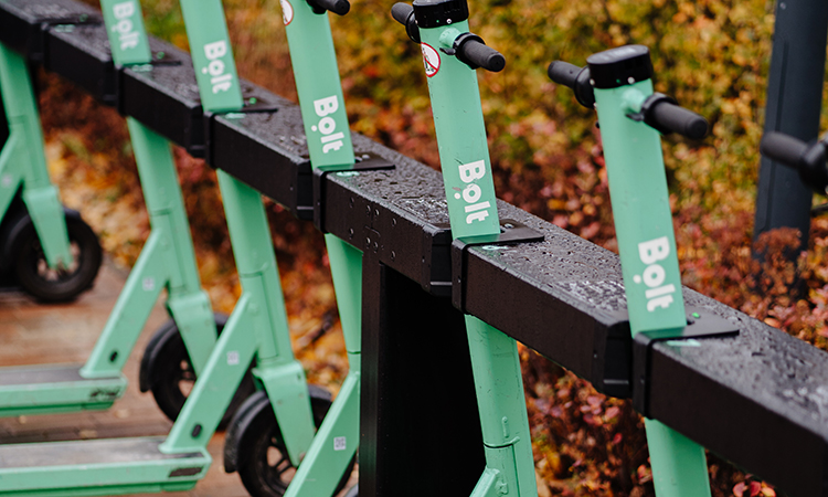
Bolt, the European micro-mobility app, has announced its largest ever funding round to further scale its existing products and accelerate the transition from owned cars to shared mobility in cities. The €628 million investment round takes Bolt’s valuation to €7.4 billion.


“For decades, cities have been built for cars, not people. That has led to unsustainable traffic, pollution and loss of public space to parking places. We think that this approach is outdated,” said Markus Villig, Founder and CEO at Bolt. “Over the past eight years, we have developed products that offer better and more affordable alternatives for almost every purpose that a private car serves. We’re partnering with cities to help people to make the switch towards light vehicles, such as scooters and e-bikes, and shared mobility options, like ride-hailing and car-sharing, to transform urban areas back into sustainable, people-friendly spaces. That’s why we’re pleased to announce this new round of funding – the biggest in our history – which will help us to build a future in which cities have less congestion, less pollution and more green spaces where people can easily move around in a safe and sustainable way.”


This news follows Bolt’s recent announcement of a range of new safety features to be incorporated on its scooter-sharing network, the largest in Europe, demonstrating how the company is a reliable partner for cities. These features include a tandem riding prevention system, which can detect more than one person riding a scooter at the same time; a cognitive reaction test to ensure that riders stay as safe as possible; and a skid prevention system, meaning that scooters are only used in a safe and responsible manner.


Scooter-sharing is just one part of Bolt’s suite of mobility and delivery products, which are currently used by more than 100 million customers in 45 countries and over 400 cities across Europe and Africa. Other products also include its ride-hailing service; car-sharing service Bolt Drive; Bolt Food, which enables customers to order meals from restaurants; and Bolt Market, a 15-minute grocery delivery service.


Bolt Market, one of the company’s newest products, was developed and launched during the pandemic and already operates dozens of stores in ten countries across Europe. With this new investment, Bolt will accelerate its expansion rapidly in 2022 and plans to have hundreds of stores operational by the end of the year.


https://www.civilengineering.ai/bolt-announces-e628-million-investment-round/

How Sensors are Advancing Telemedicine

January 19, 2022

How Sensors are Advancing Telemedicine


How Sensors are Advancing TelemedicineAlthough telemedicine has been widely available for years, the COVID-19 pandemic showed the true potential of this approach to medical treatment.


This increased dependency on telemedicine was largely fueled by the widespread interest in reducing the exposure of both healthcare workers and patients to COVID-19.


As telemedicine became implemented on this wide scale, healthcare workers began using these communication platforms to protect patients from nonurgent visits to healthcare facilities and approach more urgent situations in a more careful manner. For example, at Baylor Scott & White All Saints Medical Center in Fort Worth, Texas, the emergency department began using telemedicine communication devices to remotely monitor patients who had tested positive for COVID-19 without requiring the physician to enter the patient’s room.


Clinicians have also utilized telemedicine to remotely monitor patients admitted to the intensive care unit, thus allowing hospitals to conserve personal protective equipment (PPE) during global shortages.


In addition to offering protection for both healthcare workers and patients, telemedicine has also allowed medical treatments to become more readily available for both high-risk patients and those residing in rural populations.


Monitoring COVID-19 Patients in Isolation

When an individual first tests positive for the severe acute respiratory syndrome coronavirus 2 (SARS-CoV-2), which is the virus responsible for COVID-19, they are often recommended to remain in domestic isolation to prevent spreading the virus to others. Unfortunately, a considerable number of these patients, particularly those with certain comorbidities like cardiovascular, pulmonary, or metabolic diseases, will experience a severe form of COVID-19 that requires immediate admission to the hospital.


Some of the different ways that the progression of COVID-19 in patients who are in domestic isolation has been monitored is through measuring their temperature two to three times a day and self-documentation of symptoms.


Related Stories

UCLA’s Digital Sensor Array-Based Miniature Telemedicine Microscope

Ex nR Enclosures: What are They and Why are They Important for Safety

Ex d Enclosures: What are They and Why are They Important for Safety?

However, some of the more critical parameters, such as heart rate, respiratory rate, and oxygen saturation levels, all of which are used in the clinical setting to reduce mortality, are not typically monitored in these patients who are self-isolating.


The lack of monitoring of these parameters can lead to delayed hospital admission for severe cases of COVID-19, which can inevitably increase the patient’s risk of death.


To improve the overall prognosis of COVID-19 patients and allow for high-risk patients to be quickly identified, researchers have discussed the potential utility of remote monitoring systems for these populations.


Some of the non-invasive devices that have been studied for this purpose include a wide range of commercially available wearable devices like smartwatches and skin-attachable electronics, many of which are based on photoplethysmographic (PPG) signals.


A Novel In-Ear Monitoring Device

Another recent approach included using an in-ear monitoring device that also uses PPG to acquire information on the patient’s body temperature, heart rate, respiration rate, and oxygen saturation in 15-minute intervals.


As compared to other wearable devices, this in-ear device is placed within the external ear canal, thus allowing for its protection against disturbing stray lights and unwanted movement that could affect signal transduction. Furthermore, this location is ideal for acquiring accurate readings on body temperature.


This in-ear monitoring device is equipped with two sensors, including a photodiode that reads the PPG signal with red and infrared light-emitting diodes (LEDs) that have a combined sampling frequency of 200 Hz and a sampling depth of 19 bits. Comparatively, the second sensor is a thermometer that measures the patient’s body temperature at a frequency of 1 Hz and an accuracy of 0.3 °.


Bluetooth connects the wearable device to a monitoring system that allows for all data to be easily and safely stored and transmitted over the internet.


To evaluate the feasibility of this device in a clinical setting, a total of 153 patients residing in Bavaria with a median age of 59 were included in a recent study. These patients were monitored for a mean of 9 days, with an average daily monitoring time of 13.3 hours each day.


Of the 153 patients included in this study, 20 were referred to the hospital by a telemedicine team called Telecovid. On average, the time between a positive SARS-CoV-2 polymerase chain reaction (PCR) test and hospital admission was six days. Of the 20 hospitalized patients, seven required ICU admission, three were temporarily placed on invasive ventilation, and one died after 25 days of invasive ventilation.


Notably, none of the other 133 patients who were not admitted to the hospital experienced an unforeseen complication of COVID-19.


Overall, the in-ear monitoring device used in this study was found to provide a sufficient method of remotely monitoring COVID-19 patients over extended periods of time. Since all patients referred to the hospital by the Telecovid team were subsequently admitted for further treatment, the initial decision to bring them to the hospital was justified.


This confirms that not only did this device accurately efficiently detect serious cases of COVID-19, but it also allowed for patients who remained in isolation to be well cared for without unnecessary contact with a healthcare worker. By allowing these patients to be monitored remotely, resources were preserved while also reducing the risk of infection for both medical and nursing staff.


Future Directions

The in-ear sensing device discussed here is one example of many different technologies that are currently being assessed for their feasibility in remotely monitoring patients. Some examples of these sensors include bed occupancy sensors, toilet sensors, and call-for-help pushbuttons, all of which can immediately provide important information on a patient’s health status to their healthcare providers.


Not only are many of these novel sensing devices unobtrusive, but they also provide patients with privacy and comfort while they are cared for in their homes.


https://www.civilengineering.ai/how-sensors-are-advancing-telemedicine/

Amazon Water Cycle Observed from Space

January 19, 2022

Amazon Water Cycle Observed from Space


Amazon Water Cycle Observed from Space - EosThe Amazon Basin is the largest river basin in the world. It covers roughly six million square kilometers, which is about one third of South America. While the sheer scale and difficulty of access makes field observations challenging, remote sensing can provide rich insights. An article recently published in Reviews of Geophysics explores the strengths and limitations of satellite observations of the Amazon basin and makes recommendations for improving these observational systems.


Why is the Amazon so important for hydrologists to study?


The Amazon Basin is notable for its high rates of precipitation, evaporation, and river discharge. The latter represents about 20 percent of the total amount of global fresh water reaching the ocean each year. The Amazon’s hydrology has far-reaching impacts on regional and global climate. For example, the Amazon basin provides moisture to the southern parts of South America. As a large source of heat in the tropics and strong convective processes, it also significantly impacts global atmospheric circulation. Additionally, Amazon surface waters are a major source and sink of carbon dioxide and the largest natural geographic source of methane in the tropics.


What observational tools do scientists use to monitor hydrologic processes in the Amazon basin?


The Amazon basin is a large and remote tropical watershed, mostly covered by dense forest, which makes in situ observations challenging. There are a range of monitoring networks that measure water level and rainfall, as well as flux towers tracking CO2 exchange between the forest and the atmosphere. These networks are essential for scientists to understand hydrological processes but are also limited because of the sheer extent of the basin and the spatio-temporal variability of processes within it. Some phenomena, such as the extent of the flood, are almost impossible to assess in situ.


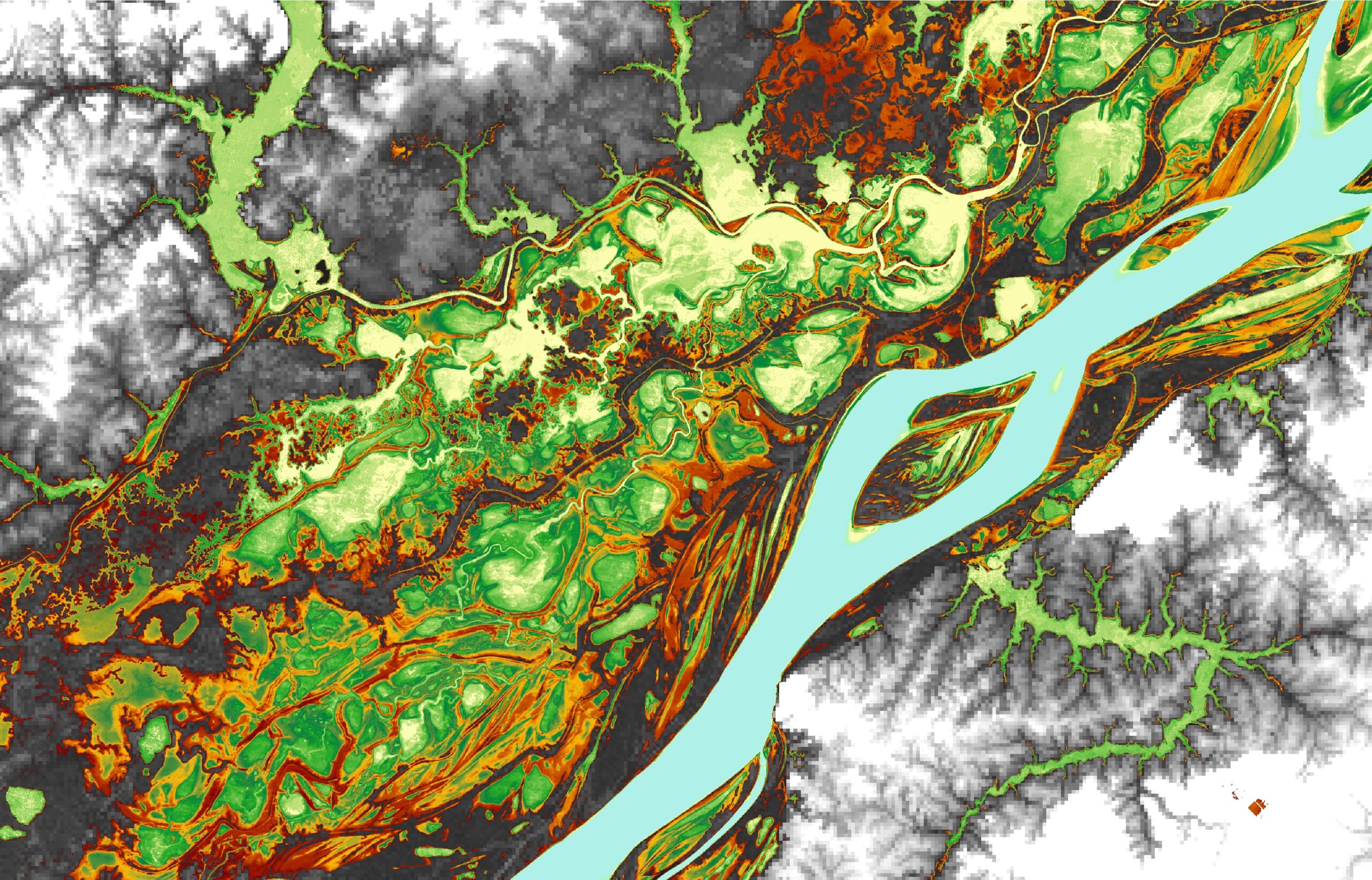
Remote sensing is a key tool to overcome these limitations because it provides a broader observational viewpoint. Satellite data can be used to estimate a variety of factors including rainfall, evapotranspiration, water level, water surface extent, sediment concentration, topography, and water storage variation over a large area and continuously. Combining both in situ observations with satellite data is a game changer for science.


https://www.civilengineering.ai/amazon-water-cycle-observed-from-space/

Geospatial Data as a Vital Tool for Protecting Planet Earth

January 19, 2022

Geospatial Data as a Vital Tool for Protecting Planet Earth


Geospatial Data as a Vital Tool for Protecting Planet EarthThis specially selected series of articles illustrates how geomatics plays a key role in protecting and preserving the environment. Geospatial data forms an important part of the toolkit of researchers and other experts involved in nature conservation. Check out these examples of how geomatics techniques have been applied in practice around the world.


Creating a Digital Twin of the Earth

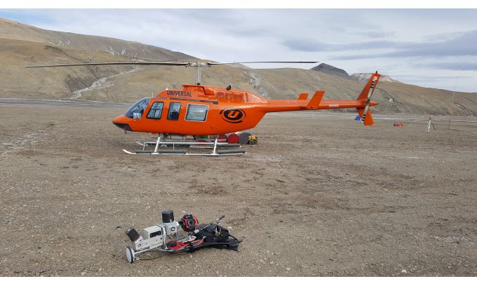
An unprecedented scientific effort to Lidar-scan the entire surface of the Earth before it’s too late... that’s how Christopher Fisher, the founder of the Earth Archive, describes his initiative. He started the Earth Archive based on his experience of using remote sensing technologies in Mexico and Honduras. His aim is to better understand the causes and consequences of urbanism and environmental change.


https://www.civilengineering.ai/geospatial-data-as-a-vital-tool-for-protecting-planet-earth/

Concrete-AI Raises $2 Million to Commercialize Data Science Platform that Reduces the Cost and Embodied Carbon Footprint of Concrete

January 19, 2022
Concrete-AI Raises $2 Million to Commercialize Data Science Platform that Reduces the Cost and Embodied Carbon Footprint of Concrete
Concrete-AI Raises $2 Million to Commercialize Data Science Platform that Reduces the Cost and Embodied Carbon Footprint of ConcreteLOS ANGELES, Jan. 13, 2022 (GLOBE NEWSWIRE) -- Concrete-AI today announced it has raised $2 million in a seed financing round with participation by the Grantham Foundation for the Protection of the Environment, a prominent family office and other marquee investors. This financing will accelerate the rollout of Concrete-AI’s pioneering data science platform that uses artificial intelligence (AI) and machine learning (ML) to optimize supply chains and materials selection to bring new efficiencies to the design, proportioning and production of concrete mixtures. Concrete-AI’s platform delivers unparalleled reductions in the cost and embodied carbon of ready mixed and precast concrete used in construction, without any changes in their method of production, the materials used or anything else.


In addition, the company announced that industry veteran Ryan Henkensiefken has joined the company as Vice President of Business Development. Henkensiefken has spent more than a decade in the concrete and chemicals industries. Most recently, he served as Market Development Manager for Master Builders Solutions (previously, BASF Construction Chemicals). Prior to this, he held business development, and engineering roles for Central Concrete Supply, a unit of U.S. Concrete.


During pre-commercial piloting with several of the largest cement, concrete and chemical admixtures manufacturers, including Summit Materials, U.S. Concrete, a Vulcan Materials Company and Votorantim Cimentos (Prairie Material), Concrete-AI’s platform has been shown to reduce the material costs and embodied carbon footprint of ready-mixed concrete (RMC) by up to 10 percent, and up to 50 percent, respectively. It achieves these reductions by applying AI/ML-enabled concrete optimization to predict the performance of concrete as a function of its mixture proportions, and the characteristics of coarse and fine aggregates, supplementary cementitious materials (SCMs), and the chemical admixture type and dosage, etc. The result is a highly optimized, cost-effective concrete that fulfills all engineering performance characteristics such as slump, set time and strength, while utilizing locally available raw materials to ensure safety, longevity and code-compliance.


Concrete-AI’s AI/ML approach for concrete proportioning helps solve some of the biggest challenges facing the industry: concrete overdesign; the embodied carbon footprint from cement (i.e., the glue or “binder” that holds the aggregates together to make concrete); increasing material cost; and reducing margins.


Traditionally, because it has been difficult to predict how the constituents of a concrete mixture will affect its performance, concrete formulations have been overdesigned such that they contain excess cement. In the U.S. alone, this overdesign costs the industry more than $1 billion annually, and results in 10 million tonnes of incremental carbon dioxide (CO2) emissions associated with cement production. If Concrete-AI were adopted globally carbon emissions from cement and concrete production could be reduced by 500 million tonnes per year.


“Concrete-AI offers the construction sector a one-of-a-kind, capital-light, rapidly deployable, Software-as-a-Service (SaaS) solution that brings new performance and sustainability efficiencies to concrete production while leveraging existing supply chains, manufacturing processes, and the power of data,” said Alex Hall, CEO of Concrete-AI. “To reduce the embodied carbon footprint of concrete construction projects, we must use materials effectively and efficiently. Concrete-AI enables this while ensuring safety, peak engineering performance and sustainability by optimizing the use of cement, aggregates, and diverse SCMs in concrete, in an unparalleled manner by a data-driven approach. At a time when states and the federal government are increasingly requiring and incentivizing the reduction of embodied carbon in the built environment, Concrete-AI offers the industry the leading data-driven solution for ensuring cost-effective and sustainable construction.”


The core Concrete-AI technology was developed at UCLA’s Institute for Carbon Management (ICM) by Gaurav N. Sant and Mathieu Bauchy. Sant and Bauchy are faculty members in UCLA’s Samueli School of Engineering in the Departments of Civil and Environmental Engineering. Sant is also a faculty member in the Department of Materials Science and Engineering and is the Director of UCLA’s Institute for Carbon Management.


About Concrete-AI

Concrete-AI is a data science company that delivers cost-savings and embodied carbon reductions in concrete production. By leveraging the power of artificial intelligence (AI) and machine learning (ML), Concrete-AI’s platform designs and proportions the optimal concrete for any construction application. This reduces costs and embodied carbon footprint of concrete, while ensuring certainty of performance, compliance with existing codes and standards.


More information is available at www.concrete-ai.com.


A photo accompanying this announcement is available at https://www.globenewswire.com/NewsRoom/AttachmentNg/37880936-aa14-41e6-af1b-4d4c33751a3a
https://www.civilengineering.ai/concrete-ai-raises-2-million-to-commercialize-data-science-platform-that-reduces-the-cost-and-embodied-carbon-footprint-of-concrete/


Preserving Cultural Heritage: Drones used for 3D modelling of Shenyang Imperial Palace

January 16, 2022

Preserving Cultural Heritage: Drones used for 3D modelling of Shenyang Imperial Palace


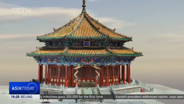
Preserving Cultural Heritage: Drones used for 3D modelling of Shenyang Imperial PalaceThe Shenyang Imperial Palace in northeast China is considered the most ancient architectural complex of the Qing Dynasty – second to the Forbidden City in Beijing. In recent years, experts have been using high-tech tools, such as drones and 3D modelling for preservation efforts of the major relic from Imperial China. Yu Li tells us more.


YU LI Shenyang, Liaoning Province "We're at the Shenyang Imperial Palace, a UNESCO world Heritage site. The drone is ready to take off to collect data for building a three-dimensional model of the Dazheng Hall, the main building served for important ceremonies in Qing Dynasty."


The digitalization of an ancient structure in the making. The drone is taking in as much details as possible by capturing large amounts of photos around the hall. It has recorded more than 4-thousand images from different angles and positions. Data conversion, at this level, would need high processing power.


XIA XINYU Engineer, Shenyang Geotechnical Investigation & Surveying Research Institute Co. "Each green spot here represents a picture taken by the drone. The location of each photo is obtained through high-precision GPS. The accuracy is at a centimeter level."


This is a digital version of the relics. The model shows every detail, including patterns on the wall and even exact coordinates of the building. Dun Limin says cutting-edge technology facilitates fundamental work for the preservation of cultural relics.


DUN LIMIN President, Shenyang Geotechnical Investigation & Surveying Research Institute Co. "The remote sensing images provide data for the early-stage resettlement of cultural relics. Three-dimensional laser scanning and unmanned aerial vehicles' close-range photogrammetry can help create 'digital twins' of historical sites. Surveying and mapping information can provide a full chain of data for cultural heritage protection."


YU LI Shenyang, Liaoning Province "There are growing concerns over damages to historical sites due to extreme weather. Social unrest, theft, and illicit excavations are other potential threats to cultural heritage sites. And its efforts like digitalization that can help preserve, or even restore them. Yu Li, CGTN, Shenyang, Liaoning Province."


https://www.civilengineering.ai/preserving-cultural-heritage-drones-used-for-3d-modelling-of-shenyang-imperial-palace/

Innovative Sensor Technology from Korea

January 16, 2022

Innovative Sensor Technology from Korea


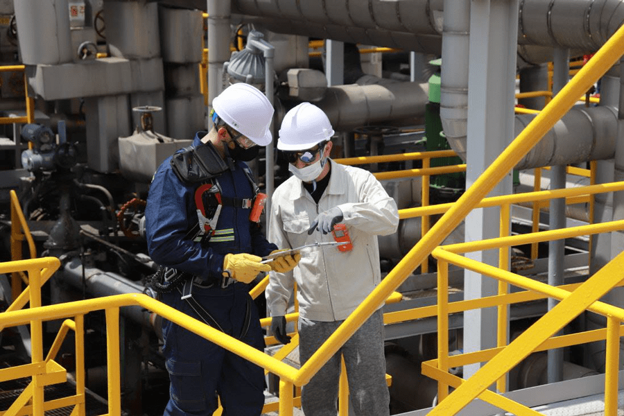
Innovative Sensor Technology from Korea - OILMAN MagazineSafety is the most critical aspect of any business, no matter what industry you are in. In any workplace setting, employees should feel safe from hazards, harmful gases and explosion risks when they start their day. Although businesses and companies have an obligation to protect their workers from getting injured, it is also a moral responsibility to demonstrate care to all employees.


We are very glad to see SENKO products in action to save millions of lives and property assets around the world. When your employees leave for work, we ensure that our SENKO products will have them return home safely to their loved ones.


SENKO is a publicly traded company in KOSDAQ, and has also recently acquired Kentek and U&E, which are manufacturers of total solutions for safety, security and monitoring systems.


Gas Detector


SGT is a single disposable detector (SGT-P is replaceable). It operates continuously for two years without the replacement of the battery or gas sensor in order to protect workers from oxygen deficiency or other toxic gases (CO, H2S, H2, NH3, SO2, NO2). It measures a gas continuously and displays its concentration and raises an alarm when a risk occurs.


MGT is a united gas detector measuring four (4) major gases, which cause the most common industrial accidents, to protect workers from the disasters caused by oxygen deficiency, toxic gas poisoning and gas explosion. It continuously measures four (4) gases (O2, CO, H2S and combustible gas (CH4)), displays their concentrations and raises an alarm.


SI-100 is a fixed gas detector installed in a place where a potential gas hazard exists to measure oxygen, toxic gas and combustible gas. It shows not only the concentration of gas but also a diagnostic result of the unit itself through the LCD display and can be connected to the controller with a standard 4-20mA analog output communication or RS-485 digital communication.


SI-H100 measures sample gas on a real time basis constantly. The monitor points up to 100 feet (30meters) away and shows an alarm of dangerous concentration and fault situation. SI-H100 assists to prevent or control a variety of gas related accidents including toxic, flammable & VOC gases in an industrial plant or semi-conductor company.


SENKO has cutting edge technology of electrochemical sensors in Korea. SENKO is supplying total solutions for safety which include the sensor, devices, system, maintenance and IOT product. Our strong growth rate in annual sales has been 25 percent over the last five years. SENKO offers you a wide range of products and always seeks to understand your needs.


https://www.civilengineering.ai/innovative-sensor-technology-from-korea/

Kansas City Airport to invest in wireless electric bus charging system

January 16, 2022

Kansas City Airport to invest in wireless electric bus charging system


Kansas City Airport to invest in wireless electric bus charging systemKansas City Airport has become the first U.S. airport to invest in a wireless vehicle charging system for its electric buses.


As part of the $1.5 billion Kansas City International Airport (KCI) New Terminal project, the Kansas City Aviation Department has announced that it is investing in the first wireless vehicle charging system installed at a U.S. airport.


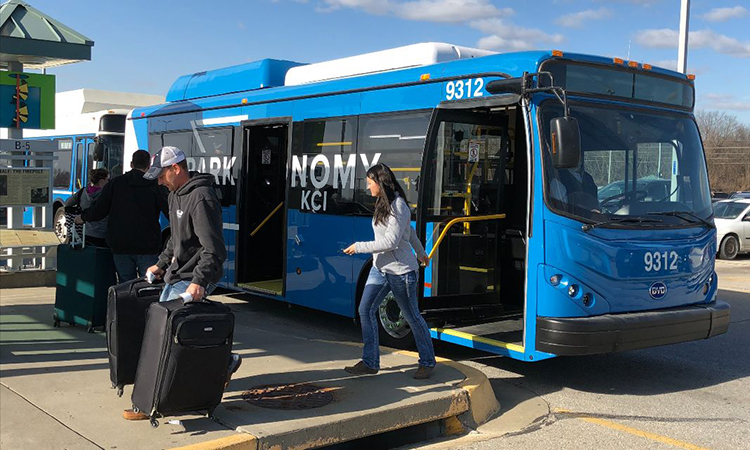
The Aviation Department will use this technology to extend the range of its electric buses without installing an above-ground charging station or taking buses out of service for charging. Momentum Dynamics will provide the charging solution, which will be in place when the New Terminal opens in 2023.


“We are designing and building a modern New Terminal, and we want to make sure that its support infrastructure does not detract from the design,” said KCI’s Acting Fleet Manager, Aaron Kaden. “Inductive charging was not only an efficient solution in terms of monetary outlay and ongoing costs, but was the only system we found that can deliver energy without the traditional plug-in infrastructure.”


Join our LIVE webinar on 20 January at 13:00 GMT on 'How Oxfordshire council improved design and public engagement using Remix Streets'


Featuring Sean Floyd, Partnerships Principal, Remix from Via and Joanna Mellon, Senior Project Manager, Major Transport Projects from Oxfordshire County Council


REGISTER NOW FOR FREE


Kansas City Airport has long been at the leading edge of environmental innovation. In the mid-1990s, the City of Kansas City, Missouri, Aviation Department was an early adopter of Compressed Natural Gas technology when it incorporated CNG vehicles into its shuttle bus fleet, complete with a fueling station. In 2017, the Aviation Department was the first U.S. airport operator to use all electric buses when it added four to its fleet and three more in 2020.


The inductive system will provide incremental charging to the existing KCI Economy Parking electric shuttle buses, thus keeping the buses in service longer along the seven-mile loop. The system will be supported by two 300 kilowatt (kW) wireless chargers located at shuttle bus stops at the New Terminal. While awaiting passengers, the electric buses will park over the charging pads and will automatically receive incremental charging. Charging takes place while passengers are loading and unloading, and each session ends when the bus leaves the pad.


BECOME A MEMBER TODAY (IT'S FREE)

Join thousands of industry professionals and claim your FREE membership, giving you access to:


Quarterly issues in print and/or digital format

Case studies, whitepapers, webinars and industry-leading content

Breaking news and features

Our extensive online archive of articles and past issues


https://www.civilengineering.ai/kansas-city-airport-to-invest-in-wireless-electric-bus-charging-system/
 
Copyright © Ai4civilengineering